
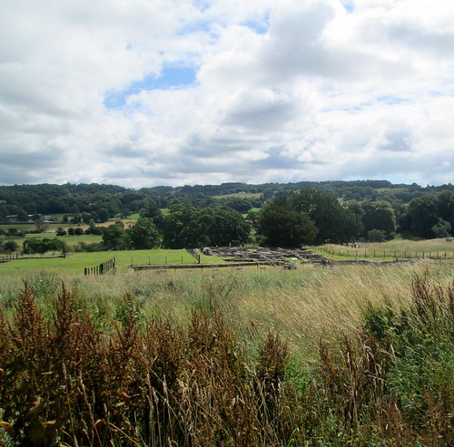
The ruins that you can see in the distance below are what remains of the camp commandant’s house. As you can see the area that the fort is set in is scenic but I imagine it would have looked a bit different in Roman times, nearly 2,000 years ago, however the land here was very fertile even back then it seems and was able to provide enough in the way of crops for humans and horses. The fort was known to the Romans as Cilurnum.
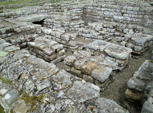
Closer up you can imagine that it must have been a lot more comfortable than any of the other accommodation, and at least he had central heating, I think the bricks are part of that system.


The floor below would have had a mosaic pattern on it I’m sure, but what can be seen in the photo are the supports of the floor.
Annoyingly I don’t seem to have an info board photo for the commandant’s house, but the HQ info board below is quite interesting.

But as you can see there isn’t much left of it nowadays.

You need a good imagination!

The info board below gives you an idea of how grand and imposing this area would have been – all to keep those barbarians from the north out!
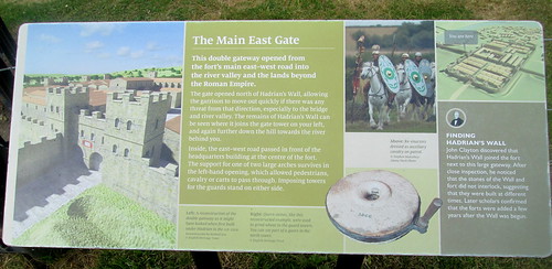
Wow, it is hard to imagine how big and grand it all was from what is left. Glad those archeologists know enough to figure it out and have an artist make a rendering!
Stefanie,
They know a lot about the dimensions of the wall and have re-built a gateway at another site, we intend to visit that one sometime. It is possible to walk the whole length of it over farmland, 82 miles I think and in parts the wall is still quite high. I always fancied walking it all but I might have left it a bit late, I would have to do it over about a week I think!
https://www.english-heritage.org.uk/visit/places/hadrians-wall/hadrians-wall-history-and-stories/history/
Your estimate of a week is about right. We have a rule of thumb for long distance walks – an hour by car on the motorway is a week on foot on the ground!
Janet,
I never thought of it that way before but I’m sure you’re correct!