Cruising from Rosyth, Fife

We chose to go on a cruise leaving from Rosyth in Fife because it’s fairly handy for us, in fact we even looked at a house in Rosyth when we were looking for a new home a couple of years ago. Rosyth is by the River Forth and for me it meant that our trip would be exciting from the very start as we would be sailing under the bridges – all three of them, and getting up close to the third one – the Queensferry Crossing, still under construction. We checked in at 4.30 pm on September, 30th – as we were asked to and by 6.00 pm the Black Watch set sail. The photo below was taken from the ship, looking over to Edinburgh.
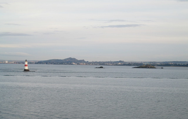
Edinburgh

The photo below is of one of the islands in the Firth of Forth, Inchcolm.
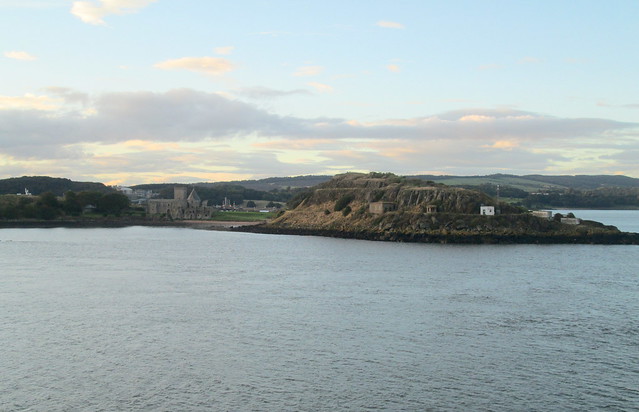
Inchcolm

The photo below is of the new bridge called the Queensferry Crossing, still under construction.
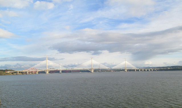
new bridge 1

The photo below is of Kirkcaldy where we used to live until a couple of years ago.
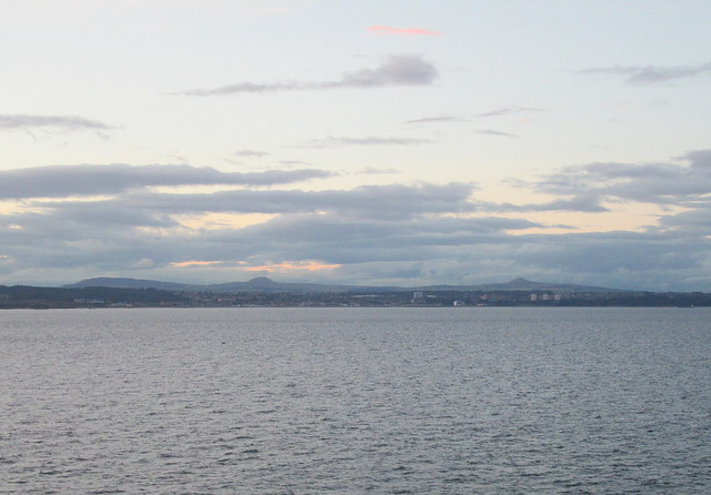
Kirkcaldy

If you look closely at the photo below I think you can just about make out all three bridges.
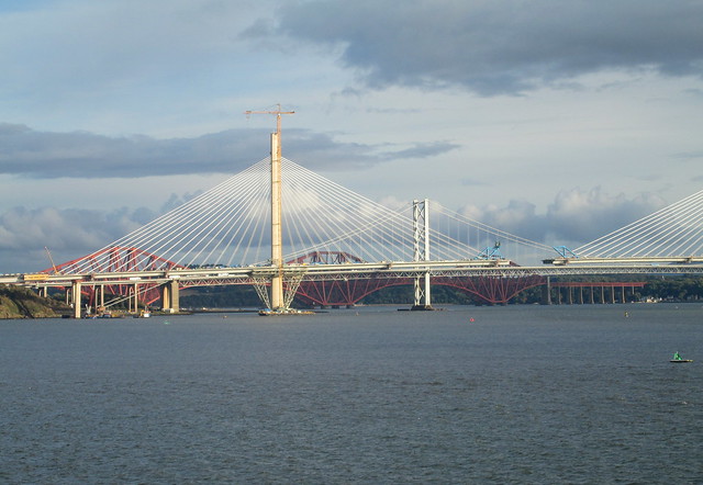
anew bridge 4

The week previously had been wild and windy but the weather had taken a turn for the worse as far as I was concerned as the North Sea that we sailed into was a flat calm. What a disappointment, I’ve always loved heavy seas, ever since going on an incredibly rough voyage to Scandinavia as a schoolgirl. Anyway, we sailed along at an average speed of 16 knots and after sailing from the North Sea into the English Channel I was a bit happier as the sea was quite a bit choppier there.

I was still wondering if we had done the right thing in going on a cruise though as I’m not really a people person. I’m fine once I get to know folks but a shipful of around a thousand strangers was a bit daunting to me. For the first few days I did a lot of reading in our cabin, apart from meal times. I must say the food was really delicious, but going out for fancy meals has never been my top way of relaxing, although I did get used very quickly to having everything done for me. The evening meal was five courses but we usually just had three courses, I think we were unusual in that.

Just about the first thing that struck us was that everybody seemed to be so much older than us. I reckon that the average age was about 80. To be fair we deliberately booked up a cruise that was for adults only, mainly because I thought it would be a nightmare if there were a lot of badly behaved kids rampaging around. It never occurred to me that going on a cruise is actually cheaper than paying for a care home – but it is, and I’m sure the care is better on board too! We did find a few people who were younger than us, some folks who were maybe only around 40 or so.

The ship seemed to be full of people who were more or less addicted to cruising, loads of them had booked up for their next cruise before this one came to an end. They claim that the sea air makes your clothes shrink!

When I started to explore the ship a bit more I noticed that there were loads of people reading books, a few using Kindles. John Grisham was very popular but I didn’t see anyone reading the sorts of books that I tend to go for. There were a fair few knitters around too. I had thought about taking some knitting as it’s getting on for my knitting ‘season’ but I really thought that I would definitely be looked on as being a bit eccentric – knitting on a cruise.

So the first few days I was a bit down and that song about Camp Granada kept running through my mind. But then we made friends with the people at the next door table, and we discovered some old friends were on the cruise, old in both ways as we’ve known them for 30 years or so and they are both over 80 and still going strong. So by the time we got to the first port – Lorient in Brittany on Monday I was feeling a lot more optimistic. Tomorrow I’ll show you some photos of that port.
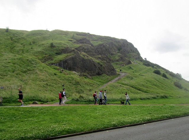
Salisbury Crags, Edinburgh

Salisbury Crags from car park

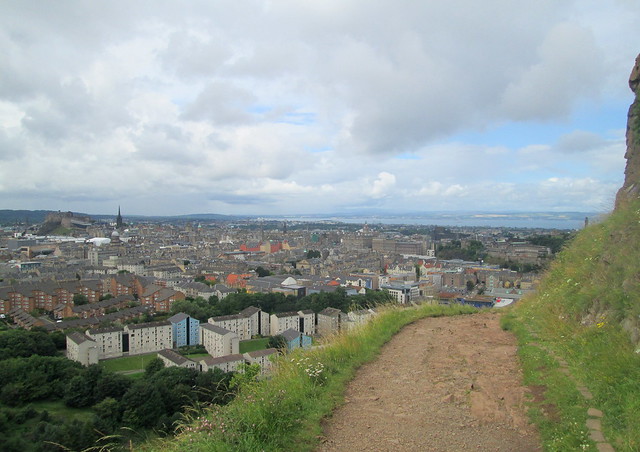
One day last week we decided it was time that we hiked up the Salisbury Crags which are a part of the rocky area to the left of Edinburgh Castle, close to Holyrood Palace. It was a lovely blue sky day by the time we got there and loads of people had had the same idea, it was a busy place. In fact I have to admit that it was only after we got home that we realised it was the Salisbury Crags we had gone up, when we were there we were under the impression we had hiked up to Arthur’s Seat – we’ll do that one next time. Sir Walter Scott calls Salisbury Crags Salusbury Crags in Heart of Midlothian, it’s thought that Salisbury is a corruption of a Gaelic word meaning Willow Brae, but it was anglicised to Salisbury at some point.

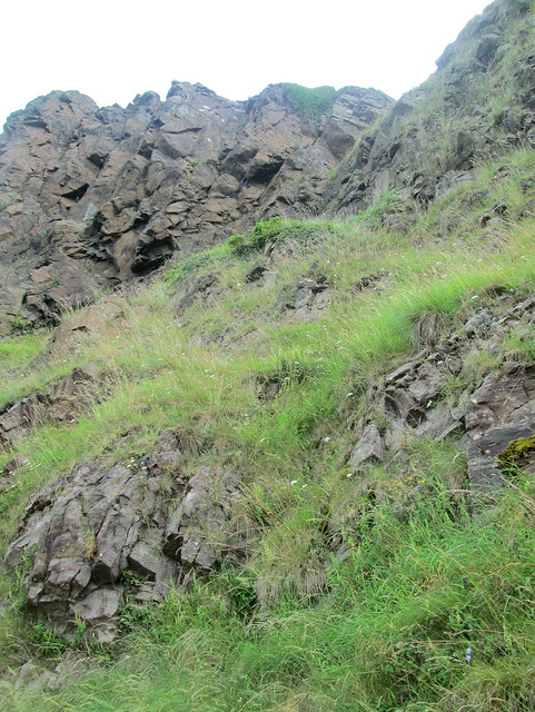
Salisbury  Crags rocks

I’m well used to hill walking and this walk looks very easy but you can’t see most of the climb from the bottom and it wasn’t long before I was beginning to think I had bitten off more than I could chew because the beginning of this hike is very steep and I was huffing and puffing up it like an old steam engine. I looked up and saw a wee girl aged about four or five twinkling down the hill on her toes, and I thought if she can do it surely I can.

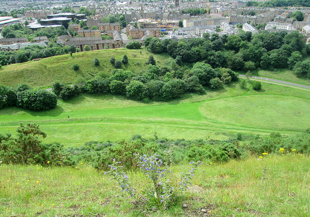
View from Salisbury Crags 13

The path soon levels out quite a bit and it’s only when you are almost at the top that it begins to get really steep again and now and again I found myself clutching at tufts of grass, but by then the top was in sight.

View from Salisbury  Crags 10

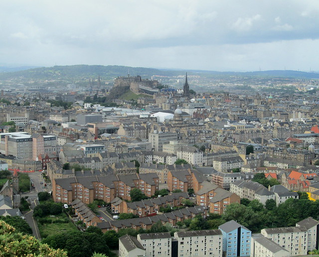
It’s definitely worth the trek as you get great views of Edinburgh from there as you can see. Unfortunately it started to rain when we got to the top, it was so windy that the rain was actually being pushed up again, curving away from the rock as it got about a metre away from it. Golden beads swooping up before getting over the edge and landing on us. Luckily it didn’t last too long as there’s no cover up there!

You can see Edinburgh Castle in the photo below.

View from Salisbury  Crags 2 castle

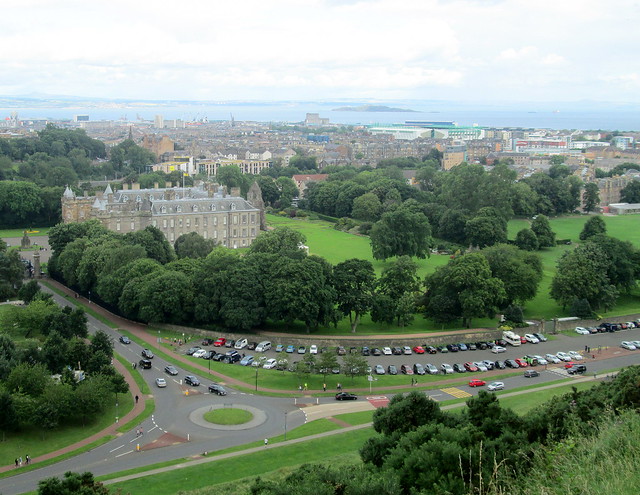
And Holyrood Palace which is just at the bottom of the Crags. There is a Royal Standard flying but I don’t think the Queen was in residence then. The Firth of Forth is in the distance, you can see one of the islands.

View from Salisbury  Crags 16 Holyrood Pal

We knew that we were going to be the worse for wear the next day, I really expected my thighs to be giving me gyp but it turned out it was our calf muscles that had taken the brunt of the strain. It was two whole days before my legs felt normal!

You can see great images of Salisbury Crags here.

Cramond, near Edinburgh

We’ve been dashing all over the place this past week trying to show Peggy some of our favourite places, and one of them is Cramond, an old village not far from Edinburgh. Cramond is a really ancient settlement with evidence of occupation as far back as the mesolithic and bronze ages as well as some of the Romans having been there.

Cramond

You can see lots of images of Cramond here, but I just took the couple of photos above and below of some lovely boats. Click them to enlarge!

Cramond

Seafield, Kirkcaldy, Fife.

On a recent walk to nearby Seafield beach I noticed that although it was beginning to spit with rain the sun was shining on Dysart Harbour to my left, I don’t know when the wind turbine appeared but it’s a plus as far as I’m concerned, quite elegant looking.

A couple of seconds later I took this photo, just a wee bit to the right of Dysart, out in the Firth of Forth there was a rainbow which you might be able to see if you look carefully, and to the right of that there’s quite a lot of rain falling.

Just a couple of minutes later we were back to blue skies, it was just about a four seasons in one day sort of day!

Walking along towards Seafield my progress was stopped by a wee river which appeared amongst the rocks and ran into the Forth. It made lovely patterns in the sand but they don’t show up that well in the photos.

I inadvertently got into the photo below, as you can see, long shadows. It was after four o’clock by this time, isn’t it great when the light nights get here again.

This picnic area is just behind where I took the photos and I noticed these two seagulls running on the spot, then cocking their heads to listen for movement underground. They’re crafty, they paddle their feet up and down to simulate rainfall, hoping to trick any nearby worms into popping their heads up out of the earth, as they do when it rains, so that they aren’t in danger of drowning. It looks comical.

We had a walk around the housing estate which you can just see in the background, just wondering if it would be a good place to move to as there weren’t many houses coming up for sale, but we decided that we definitely don’t want to live so close to the sea, especially as it was roaring in just yards away from the houses. That and the fact that not long ago Seafield was a coal-mine, until Thatcher closed it down in the 1980s. There are some lovely houses there but it’s not my idea of a safe place to live. Especially having seen all those enormous holes opening up in various towns and also houses tumbling into the sea. What with all that and having to think about the risk of flooding in lots of places, house-hunting isn’t as easy as you would think.

Braefoot and Dalgety Bay/Firth of Forth

Are you ready for another wee walk? Last Saturday was one of those dazzling bright days which you only seem to get by a coast, so we decided to drive along to Dalgety Bay for a wee bit of a change of coastal view. We had intended going to see St Bridget’s Kirk which is a very old church ruin. We’ve been passing a sign pointing to it for donkey’s years but have always just wheeched past on our way to Dalgety Bay. The photo below is of Braefoot Bay terminal as seen from Dalgety Bay.

Braefoot Bay

The sailing club is very close to where we were standing and as you can see, just to the right of Braefoot there were some yachts sailing about, it was a great day for it as the sun was actually quite warm, amazing for the time of year. I’ve never seen more than one or two yachts at a time together but this lot seemed to be taking part in a sort of sailing equivalent of an eightsome reel, it looked like good fun.

yachts in the Firth of Forth

Here they are a bit closer.

yachts  in the Firth of Forth

And again.

yachts in the Firth of Forth

We realised that due to there only seeming to be the one signpost pointing to St Bridget’s Kirk we had ended up going in completely the wrong direction. I suggested walking to St David’s Harbour to have a look at the information board there which has a map.

The result of that was we had to retrace our footsteps and go along a bit of the coastal path that we hadn’t visited before to reach the old kirk, but more of that walk tomorrow.

From the Fife Coastal Path

apath 1

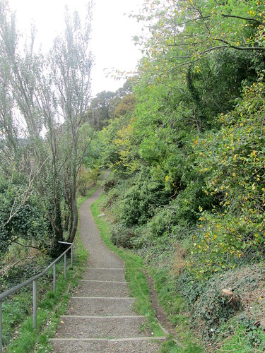
Above is a wee section of the Fife Coastal Path at Dalgety Bay, this isn’t a typical section of it though as there aren’t many steps on the path.

aMich daisies

I took a photo of these Michaelmas daisies by the side of the path as they’re a much more vibrant colour than the ones in my own garden.

alighthouse

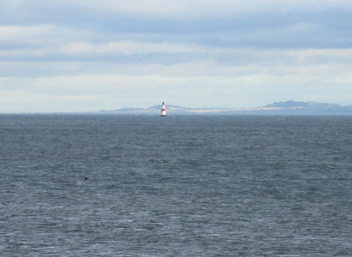
I had to zoom in a couple of times to get this one of Oxcar lighthouse which stands in the middle of the Firth of Forth. Scotland’s lighthouses were very difficult and dangerous building projects, as you can imagine from the location of this one. If you want to learn more you might enjoy reading Bella Bathurst’s book, The Lighthouse Stevensons.

atug

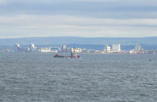
The sun was shining on Leith as this wee tug went up the Forth towards the bridges, you get a good view of them from here but I didn’t take any photos of them that day, I have so many already.

aship 2 Artemis Glory

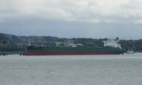
Two minutes later the sun had disappeared when I took the photo of this tanker Artemis Glory which was anchored by a pontoon, waiting for its turn to be loaded up with gas or whatever its cargo was to be.

bEdin skyline 1

And the one above is of the Edinburgh skyline as seen from Dalgety Bay in Fife.

The Sea at Kirkcaldy Esplanade in Fife

awaves 5

This is what we saw when we got to the esplanade in Kirkcaldy a couple of days ago, so we decided not to brave the actual esplanade, just in case we got wheeched into the sea by a particularly big wave. We opted for walking along by the inner wall next to the road instead.

As you can see the sea wall is badly in need of repair and in fact there is work ongoing at the moment, it’s going to take about two years to complete it I think. This is the Firth of Forth, just as it turns into the North Sea, straight ahead is Denmark I think.

awaves 7

The sea wall was built between 1922 and 24 and the work was done to give employment to men who were unemployed after the First World War, it’s quite depressing to think that we have the same problems with unemployment now. I think that the only time there has been full employment here was in those glory days of the 1960s.

awaves 12

The actual sea was almost a flat calm until about 10 feet out from the sea wall, when the waves all started to fight with each other, then exploded onto the wall.
awaves 9

Well you get the idea of what the sea was like but you can never capture it in a photo, for one thing you don’t have the accompanying noise, or the salty spray in your face. I must figure out how to work the video bit of my camera, reading the instructions would probably help!

awaves 8

Burntisland, Fife and Tyninghame in East Lothian

Well that’s the school holidays over with in the east of Scotland anyway. We didn’t go away this summer, our lives are sort of on hold at the moment as our house is up for sale now and we can’t really think beyond moving on to the next place, wherever and whenever that might be.

But a few days ago we did drive along the coast a few miles to Burntisland. This town was at one time a popular holiday destination, especially for people from the west of Scotland who fancied a wee change and a breath of eastern air.
Burntisland Railway Station
The railway station above is quite different from most others in small towns in Scotland, as you can see it was built along quite grand lines and in a classical style.

Sadly these towns have all fallen on hard times in recent years as people preferred to fly to Spain to chase the sunshine, and all the boarding houses, small hotels and B&Bs have disappeared and the town itself is down at heel, mind you the same thing can be said of most high streets at the moment.

Burntisland beach

This photo was taken close to the swimming pool, it’s of a popular beach with part of the town in the background. The town itself is quite historical, you can read about it here.

Firth of Forth

The photo above was taken from the same spot that I took the previous one, just looking in the opposite direction out onto the Firth of Forth with one of the islands in the background.

Another place that we visited last week was the teeny wee village of Tyninghame in East Lothian, we had lunch in the coffee shop there and couldn’t believe how busy it was. We were visiting friends from England who have settled there, it’s a lovely wee place but I imagine it’s different altogether in the winter time. Tyninghame is one of those wee villages which was moved in the 18th century by its owner. The Earl of Haddington apparently didn’t like the view of the village houses which he got from from his own stately home, so he had the offending buildings moved further away!

If you’re at all interested in Scotland you will find the Undiscovered Scotland site very interesting. It seems to have information on bucketloads of places in Scotland that I haven’t even heard of. I could spend an awful long time on that site alone.

Kirkcaldy Beach, Fife, Scotland

This week Scotland has been enjoying wonderful weather for once and March temperature records have been broken. It got to 73F in some places, I think it was about 69F at the beach in Kirkcaldy when I took these photos.
 Kirkcaldy shore

There were actually people sunbathing in their bikinis but I decided against shocking you. It has to be said that Kirkcaldy central beach definitely isn’t one of the bonniest beaches in Fife and there are much nicer ones just a stone’s throw in each direction along the coast. The nearby small towns of Aberdour and Kinghorn have beautiful sandy beaches too.

Kirkcaldy shore
As you can see the sand here has teeny wee bits of coal, just like grit mixed in with the sand. A legacy of the coal mining days of the area, of course all the mines were closed down years ago.
 black coal tide line

The water is beautifully clear though and this photo is actually all water as the tide was coming in. The Firth of Forth is certainly a lot cleaner than it used to be. It’s just at this point that it turns into the North Sea.
shore line
Back to the town again and you can see those three blocks of high flats which are so visible from Edinburgh and North Berwick. If you look closely you can see the massive yellow crane which is being used in the construction of the new swimming pool, although why we needed a new one is a mystery to me because the old (1980s) pool seems absolutely fine.

Kirkcaldy shore

So, that was Kirkcaldy on one of the hottest March days which we have experienced. Why is it that when it’s a hot temperature we always revert to using Imperial measurements? We go back to those 70 Fs and know exactly what it means, hot to us but mild to other people no doubt. Then when it’s cold we are back to using centigrade and moan that it’s -15 C or whatever!

Forth Bridge, South Queensferry, Scotland

I was watching our Great Leader (and I don’t think!) David Cameron on the TV news today and thankfully I was distracted by the view of the Forth Bridge which was behind him, as he was in South Queensferry, for some odd reason. I had been hoping to see a train going over the bridge in the background because they’re very frequent, about every five minutes it seems. Unfortunately I couldn’t see any, I did begin to think it was just a photo he was sitting in front of but there were seagulls flying about so it can’t have been.

Anyway, I did take a couple of photos of a train on the bridge when I was there a couple of weeks ago but I didn’t get around to blogging about them. I just wanted to show the scale of the whole thing, fairly massive I think you’ll agree! The photo below is of a train just going on to the Forth Bridge.

Forth Bridge, South Queensferry

If you look closely below you’ll be able to see the same train right in the middle of the bridge, it looks like a toy. As I said before, the whole bridge is massively over-engineered, deliberately so to give people confidence that it would be safe to use and wouldn’t collapse in a storm as the original Tay Bridge did.

Forth Bridge, South Queensferry

Somehow it still manages to look elegant, despite the tons of iron which it’s made from.